The Chincoteague Bay Canoe Trail follows the coast of shallow windswept bay formed between the island's leeward shore and the Marland and Virginia coasts.
The Canoe Trail is an excellent place for itermediate kayaker's to put some sea into their kayak touring without the risk of overmatching themselves in an open ocean environment. The bay can throw some wind and waves at paddlers. And a couple of miles across the bay's many shallow flats in an ebbing tide in a fully loaded boat is a serious work out.
That said, while a capsize on the bay would be a bad day, it probably wouldn't be your last.
With that thought in mind Chris and Tony planned four days of camping and paddling on the Chincoteague Canoe trail which follows the 12 miles of the Park's bayside coast.
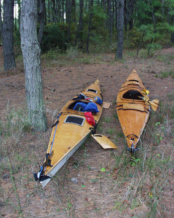
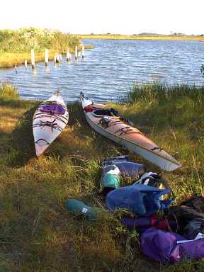
We took a pair of self-built CLC Cape Charles 18 single kayaks. This was our second trip on the Canoe Trail in these boats. On our first trip -- Spring 1996 -- Chris's Cape Charles was rudderless.
Having completed his repairs 4 years later, he was anxious to find some waves and high-winds in order to gauge an accurate comparison. He mainly got his wish.
Site 81 Oceanside
We met late Friday night at one of the group drive-in sites set in the dunes about mile from the Seashore entrance. Chris actually was there by three p.m. and had a lovely feast of Chesapeake Bay Blue Crabs back up Rt. 616 after giving up on Tony who finally showed up close to 10 p.m..
The Oceanside drive-in sites provide an extremely useful Friday night staging area for any weekend trip to the Seashore.
The sites are down a convenient boardwalk from parking. They are also very communal. Families, scouts, boaters, hikers pitch tents cheek-and-jowel the sand along a series of boardwalks sheltered by a massive berm from the Atlantic.
The island's ponies have learned that the drive-in sites are and endless source of corn syrup-based snacks and mill about picaresquely soliciting sweets. This is a bad thing and campers should resist the extortion as feeding the ponies inures them to people and cars putting them at great risk of harm.
We saw two other CLC homebuilds and met one of the owners (a modified Cape Charles 17 with a yellow hull) while we waited to determine the persistence of a small craft advisory that had greeted Chris at the ranger station first thing Saturday morning.
This had already delayed and was threatening to foreclose our departure altogether. Checking at the station again at 10 a.m., however, produced the welcome news that the advisory had been lifted Bayside and we were cleared to take to the trail.
The Old Ferry Landing to Green Run: Saturday October 7 (9 mi.)
The small craft advisory delayed approval of our departure until 10:30 a.m. and our ultimate departure until noon.
When we finally put out from the Old Ferry Landing, it was a super warm, sunny day and with the steady breeze and spray there was a palpable brine haze on the bay.
We split the shared load with Chris taking the H20 in a 5 gallon jug he set imediately aft of his seat.
In fairly typical fashion Chris tossed this in his boat, skirted up watching in dumb wonderment as Tony undertook to divvy up six bags and three days worth of groceries into dry bags and load up his boat
Apparently still hypnotized by this vision of industry he set out choosing the northwest channel out of the landing - also known as the long way round.
Tony having at last managed to find a spot for everything - save for the offbrand mallomars - set out on a southern course -- also known as the logical route.
As a result he entered the the bay just as Chris completed his circumnavigation of the island dividing the channels.
< -- /update -- >
Despite the lapse of the small craft advisory, a high, steady northwest wind continued through most of the day producing steady sets of waves quartering our generally southern course.
As a result, and despite charting a course that kept us a good half mile offshore, we had a sled ride out surfing down moderate rollers and swallowing salt from early breakers on the bay's shallow tidal flats.
This was about as much fun as you can have on the bay. Chris was a little unnerved not having been in his boat in several years. But with a little confidence in your seat, a rudder and a solid mix of strokes the bay's sand-box rollers provide rewarding technical paddling for a novice surfer.
That said, there was a good wind up and Chris's newly fastened rudder was greatly appreciated as we finally ran due east, surfing the rollers back to shore and our "final destination", putting in at close to 5 p.m.
Green run - pine tree Sunday October 8 (4.5 mi.)
We launched from Green Run at 2 p.m. on an overcast Sunday into a lovely calm for a relaxed paddle back about four and a half miles northeast to the Pine Tree site.
This was probably the quietest paddle we enjoyed on either our two trips on the bay. Assateague serves as a long and short term home for literally hundreds of varieties of migratory water fowl (ducks, geese and swans) and, of course, common sea birds.
As we paddled north, we threaded quietly through diving groups of ducks and geese and had some spectacular views of swans, pelican and heron as well.
Setting a somewhat liesurely pace and hitting some of the shallows at lowish tide, we covered the 4.5 miles in about two hours putting in at Pine Tree at close to four p.m.
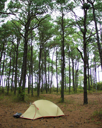
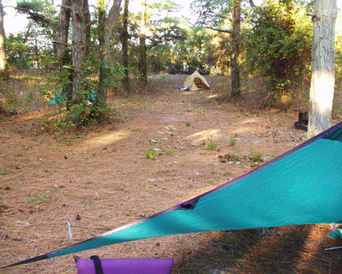
Pine Tree: Sunday October 8 - Monday October 9
Pine Tree lies at the end of a shallow arm about 4 1/2 mi by boat or foot from the Old Ferry Landing
The views on the hike to the Atlantic side of the island are spectacular as is the largely deserted ocean side beach.
We had been there four year before, early in the season when the park was virtually deserted. This time we shared the area with two teams of hikers and a father and son who came in by Gruman canoe.
We felt especially bad for the last pair the next morning as a chilly northwestly wind was howling first thing.
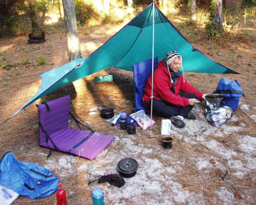
Chris was confronted with his own test first thing when he discovered he had failed to tightly secure the valve on the hanging water bag after his final draught the prior evening. As a man of honor -- and following a violent knife fight -- he surrendered his coffee ration from the nalgene bottle for Tony's paddling H20. This gesture, however, left him with a choice of either coffee or camelback.
In true dude-counterdude style, he went with the Joe. This might have been a little rash as it was shortly followed by:
Curious Little Gallery
|
Images © 2000 Chris Carroll
[Top ^]