|
Page Contents
NPS Data Guadalupe Mountains National Park Trip Maps |
In addition to the general shock and grief of those events, owing to the special security concerns regarding DC area airports, I was quite literally unable to get home for the better part of week.
Scheduled to fly home that evening, I instead arranged project work in Midland Texas and later El Paso in order to stay busy -- and keep my hotel on the client's dime!
By that weekend, however, I found myself alone in El Paso facing at least 48 hours of nothing to do and three credit cards pressed to the max. And then I thought of the Guadalupe Mountains about two hours east.
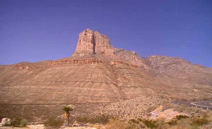
I had passed through the Guadalupe Mountains twice already on this trip and several times on earlier visits. As a dyed in the wool Easterner, I was take by the desert and the treeless Guadadlupes, particularly El Capitan, a mesa visible from the highway. (Texas-NM 62/180)

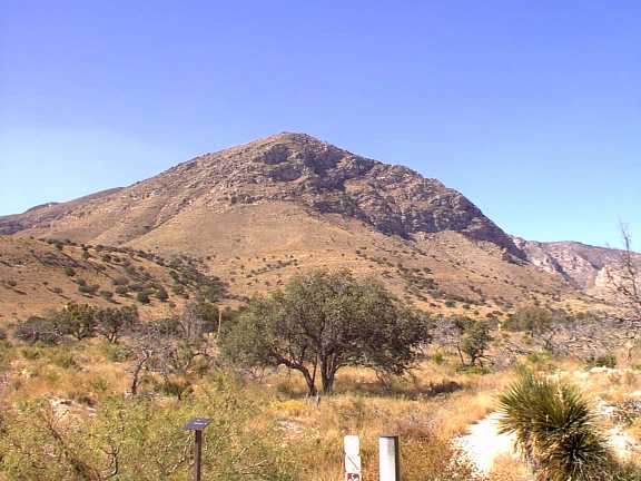
In addition while Guadalupe Peak itself (8749 ft.) is a bit of a lightweight as southwestern mountains go, it is the highest point in Texas and manages to rise a near vertical mile above the surrounding desert supplying some pretty compelling views (particularly for a boy from back east).
So I decided a day hike to the top of Texas would be the best use of my lost time.
Of course I had no equipment with me -- and restricted funds until Monday. So, I stopped at Walmart to buy a water bladder and a day pack, and at the Foot locker to buy a pair of moderately priced Addidas day hikers.
Getting There
It was a two hour drive from El Paso east to the Guadalupes on the TX/NM border along a lonely stretch of Texas-NM 62/180. The border patrol agents manning a permanent roadblock about an hour east of El Paso were suspicious at my lack of luggage and/or agricultural equipment but waved me on with a look that said, go ahead and climb that mountain, you yuppie freak.

I reached the parking lot at the trailhead to Gaudalupe Peak a little past 1 p.m. Storm clouds were gathering, and I was a hair nervous because I was unsure how long it would actually take to get to the top (a similar evelvation gain at Katahdin in Maine takes most hikers about 2 1/2 hours), and as rule of thumb I would most typically hope to be hiking downhill at this point in the day.
In addition when I went to fill my Walmart bladder, I noticed for the first time that it was missing a bite valve and was forced to jury rig a leaky clamp with a binder clip I fortunately found in the trunk of my rental car.
The Hike
Guadalupe Peak is the highest of several summits along a massif that sprouts south to north from the surrounding desert like a long narrow pressure ridge at the seam of two massive plates floating on the Earth's molten core (which it more or less is).
The approach to the southern end of the massif starts with an imediate steep climb up onto the ridge via a moderately switched trail which has obviously seen a few horses.
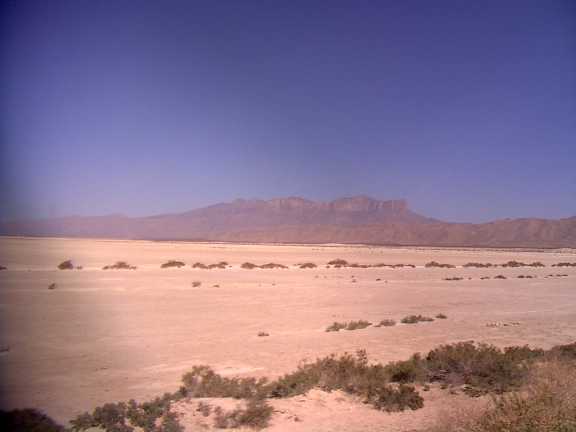
Treeline at this latitude (38°1' N) is well over 14,000 feet. However, owing to the desert climate there is in fact a reverse treeline, and below about 6000' nothing grows higher than your knees.
As a result, it is possible to see not only entire slow progress along the route, but the surrounding desert as well from virtually any point in the hike. This of course means no protection from the sun and less than no protection from a sudden storm such as the one I could see moving in from the east and probably about 5 to 10 miles off.
Following the intial approach, the final climb onto the ridgeline grows increasingly steep and is channeled into a tightly switched and deeply rutted path.
Just past the steepest section, I found a tarantula sitting square in the middle of the trail.
I waited a minute or two and then threw a couple of stones in the spider's general direction. I then waited some more. After a bit the tarantula ambled off into the brush, and I skittered like a nervous girl scout on up the trail.
At about 6500' dwarf pine suddenly sprouts from the mountainside (although it lacks the alpine feel of say the White Mountains) and the remainder of the walk is on a generally moderate grade.
The storm I had seen in the distance was now breaking up about 2 miles aways and perhaps five hundred feet below me.
By the time I made it to the summit (about 2 hours), I was good and winded and nearly out of water in my leaky bladder (no not that bladder). The summit was moderately busy and I quickly retreated down about 1000' to a side trail to a lower summit with an equally grand view of the desert where I stayed for perhaps a half an hour.
Giddy with endorphins, I raced recklessly back the rest of the way down to the parking lot in about 45 minutes and with a good hour and half of daylight.
I made it home the following tuesday and then stopped to take the pictures below when I was temporarily back in the area about 6 weeks later (although I didn't climb up again with the camera).
Curious Little Gallery

|
|
|

|
|
|
© 2001 Tony Pisarra
[Top ^]